Obstruction
Obstruction is the sky map view of one terminal in Nexus Telemetry Fleet. A Starlink terminal requires a clear view of the sky. The map shows where the terminal’s view is blocked, and the panels give the signal and the terminal’s alignment. The view is one of the 5 views of the terminal’s page, listed in the icon rail on the left once the terminal has sent a map. See Live view for the page.
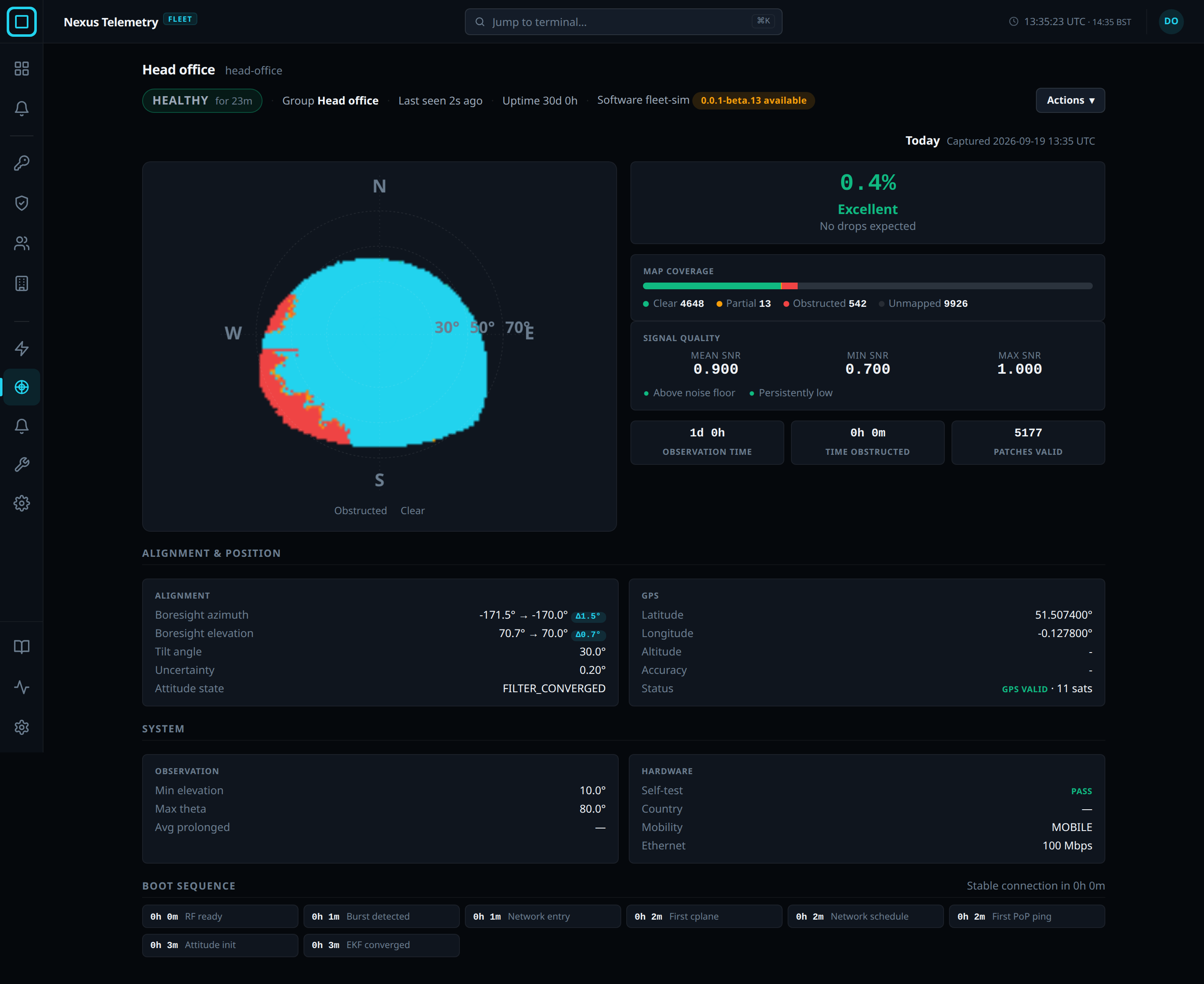
Sky map
The map is the sky as the terminal sees it, shaded from Obstructed through to Clear. The headline is the percentage of the sky obstructed, rated Excellent under 1 percent, Good to 5, Moderate to 10 and Poor above, with what to expect from it. Captured gives the time the map was taken. Clear or Obstructed below the map is the terminal’s view now, with a dot. The headline shows the same dot while the view is blocked. The terminal sends a new map once a day. It also sends one while the terminal’s Live view is open.
| Panel | Shows |
|---|---|
| Map coverage | How much of the sky is Clear, Partial, Obstructed or Unmapped |
| Signal quality | The mean, lowest and highest signal to noise ratio, and whether it is Above noise floor or Persistently low |
| Alignment & position | The direction the terminal points, its tilt, how sure it is of both, and its GPS position, satellite count and fix status |
| System | The terminal’s hardware and the Starlink settings it reports: the lowest elevation it uses, the widest angle it scans, the average length of a prolonged obstruction, whether it is set up for movement, and its wired port |
| Boot sequence | How long each stage of the terminal’s last start took, and how long the terminal took to reach a stable connection |
Earlier maps
The terminal’s earlier maps are kept, one per day. On an earlier map only the sky and Map coverage show. Earlier sky and Later sky step through them, labelled Today, Yesterday and then by date. Latest returns to the newest map.